 |
 The
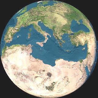
biogeographic position of the Maltese Islands seem to place these in the
Central Mediterranean where several different Mediterranean biogeographical
regions meet. Because of the continuous circulation of sea water at the
Straits of Gibraltar, the surface temperature and salinities in the Mediterranean
are variable varying between 12.7-14.5oC and 38.4-39.0 parts
per thousand respectively. The values for Maltese waters vary between 15-26oC
and 37-38 parts per thousand respectively. The continuous water flow at
the Straits also result in an outflow of nutrients out into the Atlantic
Ocean. This causes the Mediterranean Sea to be one of the poorest seas
known. Maltese waters are no exception.
The
biogeographic position of the Maltese Islands seem to place these in the
Central Mediterranean where several different Mediterranean biogeographical
regions meet. Because of the continuous circulation of sea water at the
Straits of Gibraltar, the surface temperature and salinities in the Mediterranean
are variable varying between 12.7-14.5oC and 38.4-39.0 parts
per thousand respectively. The values for Maltese waters vary between 15-26oC
and 37-38 parts per thousand respectively. The continuous water flow at
the Straits also result in an outflow of nutrients out into the Atlantic
Ocean. This causes the Mediterranean Sea to be one of the poorest seas
known. Maltese waters are no exception.
The Mediterranean coastal
environment may be divided into several zones. The uppermost region is
the Supralittoral Zone which is permanently exposed to the air but
is kept wet by sea-spray and high waves. The second zone is the Mediolittoral
Zone which is regularly exposed and submerged through wave action.
The third zone is the Infralittoral Zone which extends to a depth
of about 30-40 m depending to the extent of light penetration. This zone
is followed by the Circalittoral Zone which extends to about 200
m and represents the maximum depth at which plant life of any sort can
live. These four zones make up the Littoral System. Beyond this depth starts
the Deep System which in the Mediterranean is made up of the Bathyal
Zone (200-3000 m) and the Abyssal Zone (3000-6500 m). The Hadal
Zone (>6500 m) is not represented in the Mediterranean. The Littoral
System zones can vary according to whether the substratum consists of hard
rock or soft sand or mud. Each substratum or zone type houses typical flora
and faunal assemblages which vary from one locality to another.
|
