
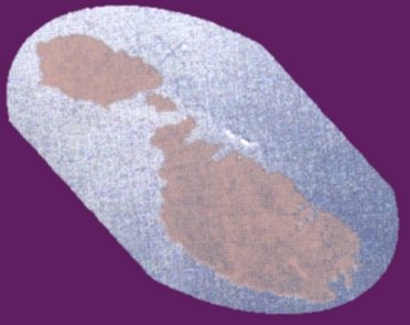
 Maltese Archipelago
from 228 km altitude
|
 The
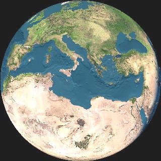
group is situated in the middle of the Mediterranean Sea, with Malta being
93 km away from Sicily and 288 km from North Africa. Gibraltar is 1826
km to the west and Alexandria is 1519 km to the east. At their extreme
points the Maltese Islands fall within the following points: Northern latitude
36o35'00", Southern latitude 35o48'00". Eastern longitude
14o5'00", Western longitude 14o10'30".
The
group is situated in the middle of the Mediterranean Sea, with Malta being
93 km away from Sicily and 288 km from North Africa. Gibraltar is 1826
km to the west and Alexandria is 1519 km to the east. At their extreme
points the Maltese Islands fall within the following points: Northern latitude
36o35'00", Southern latitude 35o48'00". Eastern longitude
14o5'00", Western longitude 14o10'30".
Geology: The
Maltese Islands are composed of a block of Oligo-Miocene limestones and
marls with very subsidiary Quaternary deposits. The Oligo-Miocene succession
is a simple "layer-cake" arrangement of Lower and Upper Coralline Limestones
with intervening layers of soft Globigerina Limestone, Greensand and Blue
Clay. The Tertiary sequence represents a succession of sediments deposited
within a variety of shallow water marine enviornments. The Archipelago
probably emerged from below sea-level at the end of the early Pliocene
period. Palaegeographical evidence suggests that throughout the Quaternary
period, the Maltese Archipelago was connected at various stages to Sicily,
east Mediterranean lands, Sardinia, Libya and Tunisia.